Project schedule
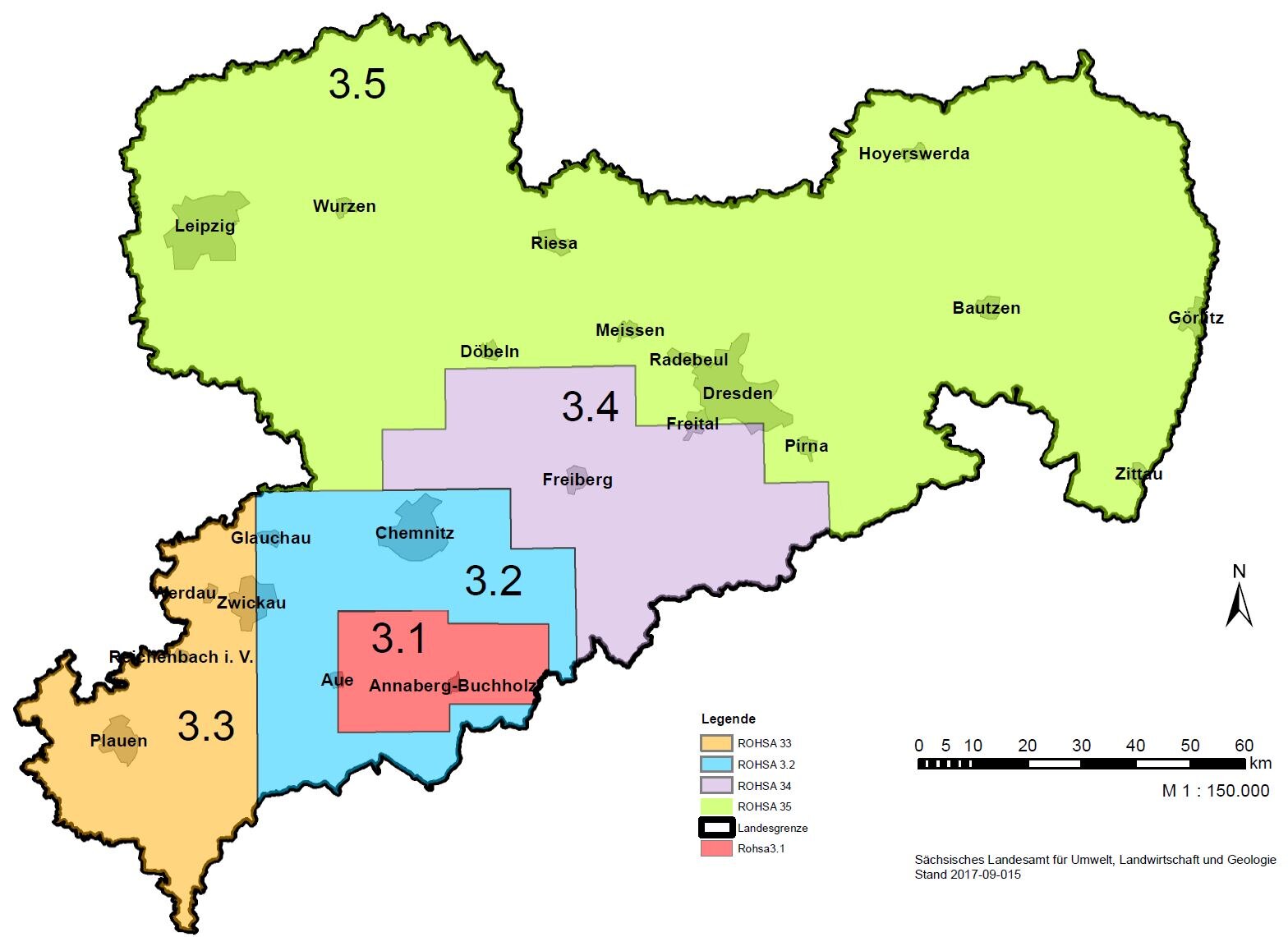

The project area is divided into several parts, which have been processed in independent phases. These had been designed for 2-year slices.
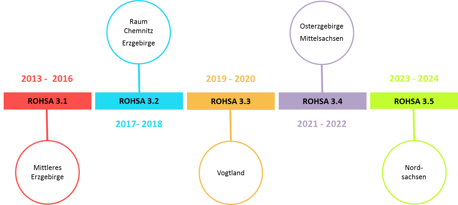
The project area is divided into several parts, which have been processed in independent phases. These had been designed for 2-year slices.
