Manual on GEOLOGIE search engine
Operation
Search mask
The search mask consists of four components:
- Search term
- Rectangle search
- Prefilters
- Button to start searching
Search term
The returned hits contain the search term(s) at least once somewhere in the stored data. The use of upper or lower case letters is not important. Equally unimportant is the grammar because the root word is used only.
The following operators are supported:
- AND (the hit contains both search terms: standard operator if two or more search terms are entered)
- OR (the hit contains at least one of the two terms)
- NOT (the hit does not contain the following term)

By using inverted commas, several words can be summarized to become a phrase. The only hits supplied are the ones containing exactly this phrase.

Rectangle search
By using this tool, the search can be narrowed down to a rectangular section of the map. The only hits then found are those that can be allocated geographically to this rectangle. Hits can be allocated to points or areas and are shown if they are fully or partially located in the search rectangle.
There are two possibilities to select a rectangle:
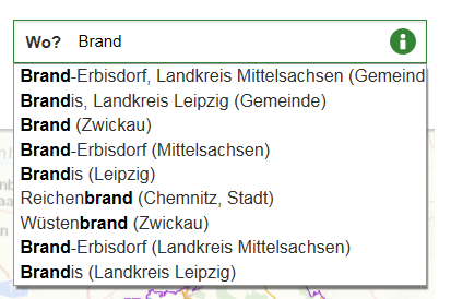
- Entering a geographic location (place, district, rural district)
- Drawing a rectangle on a map.
While entering a geographic location a list of proposals is generated automatically. An entry from this list must be selected. If this is not done, the search will be extended to cover the whole of Saxony.
The button next to the search slot can be used to enable the drawing function. When the button is active, the mouse can be used to draw a rectangle on the map. To this end, click a point on the map and move the mouse over the map, keeping the button pressed until the relevant rectangle has been created.
When you disable the button, the rectangle will be deleted again. It means that by enabling and subsequent disabling of the button a rectangle can be deleted after the search has been triggered.
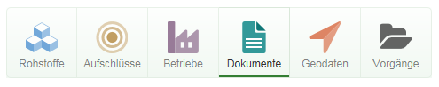
Prefilter
The prefilter is used to narrow down the search to certain hit types. When a button has been enabled, none other than the related hit types are included. If no button has been enabled, the search will include all hit types.
Start searching
By clicking the button, the search starts with the criteria selected.

Hit display
The hits are displayed in two ways:
- Hit list
- Map
Hit list
The hit list outputs hits in an orderly manner. The sorting is done based on the relevance of the hit for the search query. The most relevant hit is on the top of the list. The list is divided into pages always showing 20 hits per page. The top of the hit list indicates the total number of hits and the hits currently displayed. The bottom of the list has a control element used to browse the individual pages.
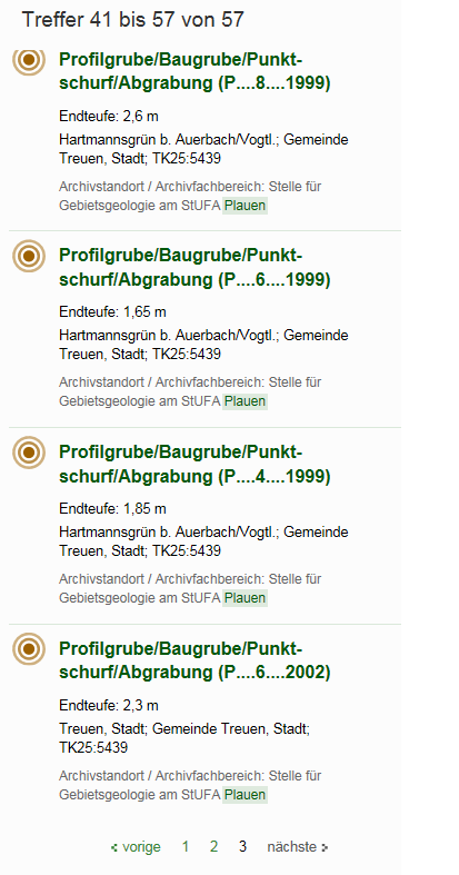
By clicking a hit you will be forwarded to a detail page. The latter is provided either by the search engine itself (hit types of boreholes, raw materials, operations, geodata) or third-party applications (hit types of documents, processes). The icons in the hit presentation mark the relevant hit types.
Map
The map can be moved by clicking and dragging the mouse cursor. Zooming can be done by using the control elements in the top left corner of the map or by using the mouse wheel.
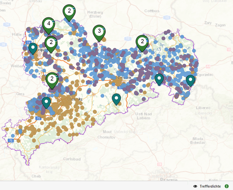
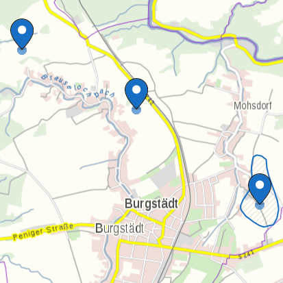
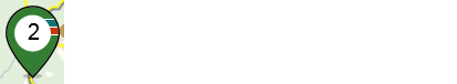
As a general rule, the map shows only hits for which the relevant coordinates (point or area) are stored. The hits of the current page of the hit list are displayed only. The hits are shown in the form of pins. Colour and icon of the pins mark the relevant hit type.
When it comes to areas, the pins are positioned in the centre of the relevant area. When the rectangle search is on, the pins are placed in the middle of the interface between the rectangular surface and the hit area.

When hovering over a pin of an area hit, the relevant area will be shown.
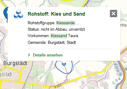
When a pin is clicked, a tooltip opens which contains the same information as the hit list. In case of area hits, the relevant area is also shown. Tooltip and area remain active until a different pin is selected or the tooltips closed with the cross symbol in the top right corner. The detail page opens when clicking the tooltip (see hit list).
If several pins are closely positioned to each other on a map, they will be grouped. The groups are symbolized by a circular icon. The number on the icon is identical with the number of the pins in this group.
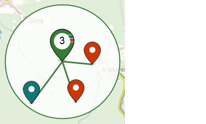
When you click on a group, the map section will be enlarged so that, if possible, all hits of this group are shown on the map as individual pins. If several hits have the same coordinate, the grouping will be shown even at maximum zoom. A click on the group will then unfold the associated pins.
Filter
The amount of hits can be limited by filtering. The filters shown are grouped by hit types and depend on the relevant search result.
If, for instance, there are two kinds of exploration in the hits of the borehole type, these two will be offered in the relevant filter. It is possible to hide or unhide the filter groups by clicking the header.
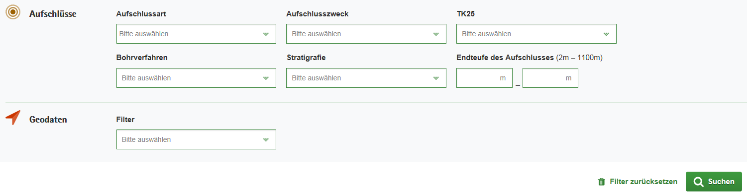
There are two types of filters:
- Input field with dropdown list
- Input field for minimum and maximum target depth
The filters selected must then be enabled by the "Search" button. All active filters can be reset by the "Reset" button.
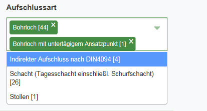
Input field with drop-down list
When you click the input field, a drop-down list will appear showing the possible attributes. When you click an entry, it will be added to the selection and shifted to the input field. This operation can be repeated as often as needed.
It is possible to limit the selection by text input so that a certain attribute can be found more easily.
By clicking the cross symbol, a selected entry can be removed from the selection.
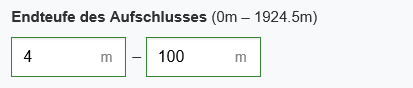
Input fields for minimum and maximum target depth
The hit list can be narrowed down by entering a minimum and/or maximum target depth. The target depth of the current hits is indicated behind the filter header. Entries in these fields must be located in this section or are adjusted in case of wrong entries.
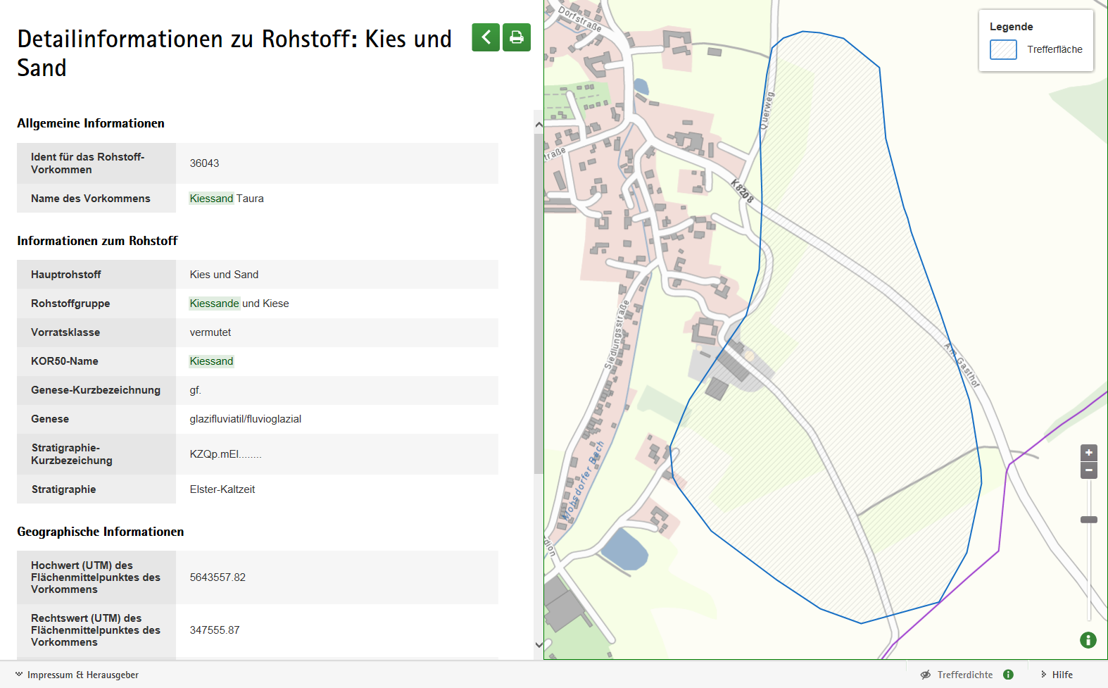
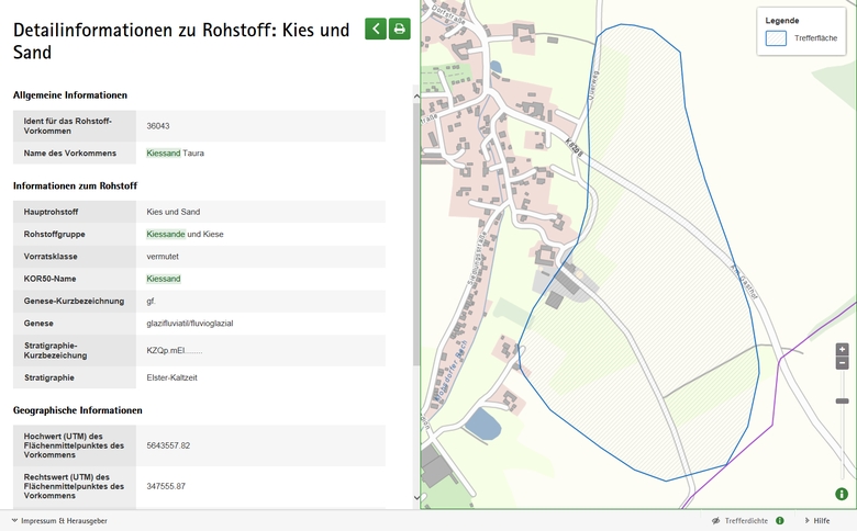
Detail page
The detail page shows detailed information on the hit in tabular form. When point or area hits are concerned, a map is shown additionally.
On the detail page for hits of the geodata type links for further information in the form of buttons are additionally shown.
Features of touch devices
- No rectangles can be drawn on a map
- A onefinger tap is equivalent to one click
- Map zooming is by twofinger dragging
- Scrolling is done by onefinger swipe